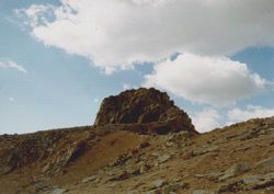
 A wonderful two days in the Sierra! I spent two hours on Pothole Dome in Tuolumne Meadows watching stratiform lenticular clouds form over Mt. Dana and Mt. Gibbs and measured 35 mph winds at Ellery Lake. The next day I had a wonderful hike up the Sierra Crest via Saddlebag Lake. Although my destination was Mt Conness, the icy conditions on the crest made it too dangerous (at least for a wimpy hiker like me) to proceed. Yet my inability to reach the summit didn’t mar the beautiful day one bit. Blue skies, 60F temperatures and a rainbow of oranges, browns, and reds of the fall landscape made for a perfect hiking day.
Mt. Conness (Almost)
This is probably the most beautiful hike I’ve taken in the park. The landscape changes with every mile, from green watered meadows covered with wildflowers, to sheer walls of granite, to alpine lakes, glaciers and glacier-swept plateaus, and finishing with a panoramic view of the Sierra atop a majestic peak.

A tributary of Lee Vining Creek runs through the basin, feed by the alpine lakes above, and the water creates lush meadows of wildflowers and miniature waterfalls. It’s a peaceful walk up a gradual uphill and I tread softly, enjoying the sun and the brisk breeze that strolls through the meadow with me.
At the end of the basin we halt, confronted with the Sierra Crest, a very imposing wall of sheer granite. We are all perplexed and wondering just where the heck the saddle can be in these cliffs, which appear inaccessible. After a consulting the topo map, we all have different ideas on the route, yet with more luck than skill we manage to find the correct way to the saddle. It barely passes for class 2, and is probably more appropriate for mountain goats, but I have to admit the scramble up is fun.
The top of the saddle affords us a fine view of Young Lakes and we find ourselves in a large open plateau on top of the Sierra Crest. The cliffs hid well the relatively flat expanse we now encounter. North Peak and the Sierra Crest have guarded Mt. Conness for most of the hike, but as we follow the ridge, the peak is unmistakable. Before the summit we encounter a land of wind swept sand and rock formations shaped like stalagmites. A small blue mini-lake lies in the middle of the sandy field, and some industrious person built a rock windbreak next to it.
The last few hundred feet to the summit is not for those who fear heights, like myself. On either side of the route is a drop off of a thousand feet, and although no technical rockclimbing is required, it’s still pretty exposed. At one point on the trail, where thin boulder lie on their sides like shark fins, vertigo hits. I peer over the side and my legs start to shake. "I think I’ll just sit here for awhile," I tell Shad, who is fearlessly snapping photos of the Conness Glacier below. After my vertigo passes, I continue on, keeping my tunnel vision. Safely atop a large, secure pile of boulders, I can now reap the rewards of the view (and the chocolate chip cookies I saved for the summit) without feeling dizzy.
